The Women of Berg Field Center

May 20, 2010

Rosemary Garofalo, Elizabeth Morton, Mimi Fujino, and Kathy Young in Kangerlussuaq, Greenland. Photo: Marie McLane

The stars and planets and whirlwind lives of some legendary women aligned a few weeks ago. The women, each of whom fledged her polar career at the McMurdo Station, Antarctica field gear shop called the Berg Field Center (BFC), bumped into each other in Kangerlussuaq, NSF’s research program hub in Greenland.  Their combined years represent decades of service to the antarctic research community. 

We got to thinking about how many of us at Polar Field Services have worked in the BFC. Our Kahuna, Jill Ferris, got her start there in the mid-1980s. Greenland project manager Robin Abbott, Science planner Karla College, and Alaska staffers Marin Kuizenga and Matt Irinaga also are BFC alumni. Who else?

“I’m married to a former BFCer (1980-1985), does that count?”–Robbie Score, married to Rob Robbins

“”Yes, I too married a BFC person. Steve [Munsell] spent one year working there. He made the round table that everyone sits around and it is still there today. His year was in 1986.”–Kathy Young

“Fun days indeed!!”–Robin Abbott


Keep on TREC-ing

May 19, 2010
By Marcy Davis

Pictured outside the University of Alaska Museum of the North, the 2010 PolarTREC teachers and alumni (left to right), Jeff Peneston (Icebreaker Oden-2008), Jim Pottinger, Josh Dugat, Cheryl Forster, Chantelle Rose, Mike Lampert, Keri Rodgers, Karl Horeis, Tina Sander, Michele Cross (McMurdo Station-2009), Craig Beals (Summit-2008), Anne Marie Wotkyns, Bill Schmoker, Lesley Urasky, and Claude Larson. Unless otherwise noted, photos by Kristin Timm, Arctic Consortium of the United States, for PolarTREC

It’s that time of year again! Janet Warburton and Kristin Timm of the Arctic Research Consortium of the U.S. (ARCUS) are preparing K-12 educators from across the United States for upcoming field experiences in the Arctic and Antarctic.  Twelve teachers who spent a week in Fairbanks, Alaska, in April for the PolarTREC Orientation and ShareFair, an intensive week-long introduction to the professional development experience.

PolarTREC (Teachers and Researchers Exploring and Collaborating), now in its fourth year (and with a recent NSF funding renewal through December of 2013), is a professional development program for K-12 educators focused on improving science, technology, engineering, and mathematics (STEM) education.

Through teacher-researcher collaborations and hands-on field experiences, teachers become an essential bridge between cutting-edge polar science and the public. By working closely with selected PolarTREC research teams through application review and teacher interviews, researchers and teachers are matched across a wide range of scientific disciplines to ensure that teachers’ interests are aligned with science project goals. After much training and preparation, teachers spend 2-6 weeks in the field with their research team. During their time out, teachers share their experiences through webinars, multimedia journals, and bulletin boards on PolarTREC’s interactive Web site.

Ann Harding and Rachael Orben prepare to take blood samples of captured birds, Kap Hoegh, Greenland. Photo by Mary Anne Pella-Donnelly (PolarTREC 2007), Courtesy of ARCUS

PolarTREC’s mission includes increasing teachers’ knowledge of polar science along with their ability to teach pertinent science concepts. The program allows teachers to improve their instruction by participating in a new and exciting research experience, exposing them to new ideas and incorporating technology both in and out of the field. Teachers also develop new curricula, which is disseminated through the PolarTREC site. PolarTREC wants their teachers to inspire students to become more aware of the Polar Regions and explore opportunities to further their education and explore occupations in STEM areas.

During the PolarTREC orientation teachers learned background science content, how to communicate successfully from the field, and how to develop polar science education and outreach plans and ideas. Hands-on breakout sessions include digital photography, journaling methods, using educational technologies, and bringing science into the classroom. PolarTREC teacher and research alumni as well as representatives from CH2M HILL Polar Services (CPS) were also on hand in-person and virtually to share experiences and address teacher questions and expectations.

Following a presentation from Roy Stehle of SRI International (part of CPS), teacher Anne Marie Wotkyns practiced using the satellite phone by calling home from the Westmark Hotel parking lot. Wotkyns will work with scientists on the Icebreaker Oden in November.

PolarTREC Alumni, Craig Beals (Summit-2008), offers advice to the new group of teachers. Three PolarTREC alumni were on hand during orientation to share information and lessons learned about their field experience, maintaining collaborations with the research team, and taking PolarTREC back to the classroom.

Matt Irinaga of Polar Field Services (part of CPS) explains the science of cold weather dressing: layer, layer, layer! Photo: Robbie Score

We’ll be checking in on PolarTREC teachers during their field experiences – stay tuned! 


GrIT: On to Summit

May 18, 2010
 All photos: Robin Davies

The GrIT team greets Zoe Courville at NEEM.

After about three weeks and 400 miles—many of which were wind-blown and snowy on the soft, roadless route toward Summit—the Greenland Inland Traverse team (GrIT) rolled into the international deep drilling camp NEEM last Thursday, 12 May. 

GoNorth! Too  

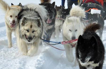
The Polar Husky superstars of GoNorth! arrived on the 12th as well, in time for project members with teaching and other commitments to meet the flight scheduled for the 13th. Of course that flight was delayed a day due to weather on the ice cap, but eventually the plane came, and personnel were appropriately shuffled.  

The GoNorth! Polar Husky super stars run into NEEM camp.

Exit Jim Lever, Enter Zoe Courville

The GrIT team welcomed Zoe Courville of CRREL on Saturday. We hear the mood was festive at NEEM camp that evening, as many camp personnel were newly arrived on the day’s ANG flight, as well.  The NEEM blog site notes that “Everybody had a fine evening, and a lot of people joined in the mid-night dance, featuring the Danish group “Sweet hearts.” 

Back to work on Sunday: The GrIT team conducted maintenance on traverse vehicles, delivered 1500 gallons of fuel to NEEM, and reconfigured the loads, shifting another1500 gallons of fuel to the Tucker’s fuel bladder. Net load reduction for the Case: 21,600 pounds. “The Durabase (a semi-flexible plastic bed) is now on High-Molecular-Weight sleds to see if the sleds reduce the drag,” project manager Allen Cornelison noted. 

The team headed out for Summit on Sunday, another ~430 miles ahead.  On Monday “the Case was able to grab 7th gear,” a first, wrote Cornelison.  Still, “it was unable to go any faster probably because it was making 14-inch ruts.”  Despite soft snow conditions, the team advanced 45 miles.  

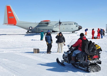
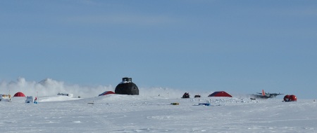
The LC-130 airplane (right) blows off the runway at NEEM. Skiway conditions were soft due to warm temperatures and wind storms. The "Iconic NEEM Dome" (the camp's main building) is seen just left of center.

More Sled Mobility Tests

The qualities of Greenland’s snow surface and sled mobility are clear foci of the GrIT’s experimental component. Before departing on the traverse, CRREL personnel at Thule fitted the Durabase sled with sensors that collected data at the snow/sled interface; when he returns to CRREL, Lever will analyze these data in hopes they shed light on how to make the interface more slippery. 

Back at Thule earlier this spring, Jim Lever prepared the HMV sleds for mobility experiments. Here, the sled is outfitted with heaters. The sensors to collect data on temperature and mobility can be seen along the edges. A second sled was tested using enhanced passive (solar) warming methods.

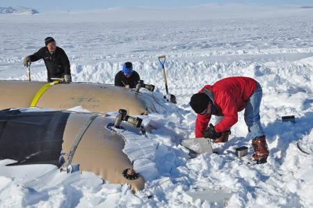
Jim Lever (right) changes batteries powering a datalogger collecting information on the mobility of the HMV sled with passive warming. The brown fuel bladder is covered with a radiation-absorbing black material. In the background, the second HMV carries a fuel bladder without the black material, for comparison. Allan Delaney (left) and 'Swing Boss' observe.

In addition, after departing the GrIT, Lever flew to Summit Station, where he is conducting mobility tests on a raft purchased specifically for traverse development.  Jim’s findings may be applied to improving bipolar mobility—for GrIT and its southern cousin, “SPoT” (the South Pole Traverse). 

The Greenland Inland Traverse is funded by the National Science Foundation (NSF). CH2M HILL Polar Services and Cold Regions Research and Engineering Laboratories are working together with the NSF to develop the traverse infrastructure and route. The 2010 spring traverse has several foci: find a safe overland route to Summit Station to help reduce logistical costs and environmental impacts of conducting research there; provide a research platform for scientists conducting field work in Greenland; optimize mobility by focusing on the sled/snow interface.  For more field notes coverage of GrIT, click here 

GrIT contact:
Allen Cornelison, Polar Field Services, CH2M HILL Polar Services
GrIT project manager

Burning Questions

May 17, 2010

Scientists Seek Information from the Anaktuvuk River Fire

By Emily Stone

Journalists visited the site of the Anaktuvuk River Fire last summer. The charred tussocks were still visible beneath the blooming cottongrass. Photo: Lisa Jarvis

Gaius Shaver has been traveling to Toolik Field Station for 34 summers to study how tundra ecosystems react to small environmental changes. One of his experiments involves building greenhouses over 8-by-16 foot plots of land to gauge how plants react to warmer soil.

His research has yielded interesting results over the years, but there’s always been a question of how well that data would translate over large tracks of land.

Suddenly, Mother Nature gave Shaver and many other Toolik scientists a way to find out.

A massive fire burned about 400 square miles of tundra along the Anaktuvuk River from July to October 2007. It was the largest tundra fire ever recorded on Alaska’s North Slope. Now the scientists are studying how the area, which is roughly the size of Cape Cod, responds. In addition to examining the warming soil and plant changes, the group is looking at how much carbon was lost in the fire, the ongoing exchange of carbon between the land and air, and how melting permafrost is affecting rivers and streams. They’re finding that the fire has had a significant impact in all these areas. And given that continued warming in the Arctic will likely lead to more lightning which will lead to more fires, these are important questions to answer.

The 2007 Anaktuvuk River Fire burned a Cape Cod-sized section of the North Slope. Scientists are interested in how long it will take the area's plants and soil to recover. Photo: Adrian Rocha

“There’s a lot going on,” said Shaver, a senior scientist at the Marine Biological Laboratory who is leading the National Science Foundation-funded, three-year study that includes nine senior collaborators and a couple dozen other researchers. “It’s very exciting.”

The group calculated that the fire burned more than two million tons of carbon that had been stored in the soil, or roughly 25 years worth. This equals about 10 percent of the annual carbon emissions for the city of Boston. The fire also burned between 300 and 1,000 years worth of nitrogen.

The group is also interested in the continued changes in carbon exchange between the soil and atmosphere. Using instruments set up on three towers in the burn site, they’re measuring the exchange of carbon during the summers. If plants photosynthesize more than they and the soils in which they grow respire, then the net result is carbon being removed from the atmosphere. If there’s more respiration than photosynthesis, then the opposite is true.

Overall, the burned areas have a net carbon loss from the soil, meaning more carbon is being released into the atmosphere than at unburned spots. The researchers calculated that in 2008, the fire accounted for a minimum 2.8 percent reduction in the amount of carbon being taken out of the atmosphere across the North Slope even though the Anaktuvuk River Burn accounts for only 0.55 percent of the North Slope’s area.

The researchers know from older fires and erosion scars that shrubs tend to dominate the landscape after a disturbance at the expense of mounds of tussock grasses, which cover much of the North Slope. This seems to be playing out at the Anaktuvuk River Burn. Although shrubs were knocked back dramatically by the fire — even more than the tussocks — they are recovering rapidly even in severely burned areas and may soon exceed the grasses in the amount of ground they cover. 

Undisturbed tundra tends to keep its plants in pretty consistent ratios as they compete for limited resources in the soil. “A disturbance shakes up those relationships among species,” Shaver said. This is important because shrubs tend to insulate the soil in the winter, keeping it warmer, and also hold less carbon below ground than tussocks do, both of which can further change the landscape.

Another striking discovery is the change in albedo, meaning the percent of the sun’s radiation that is reflected away from the ground. In the first summer after the fire unburned portions of the burn site had a 17 percent albedo while severely burned sections had a 3.5 to 4 percent albedo. That means an additional 13 percent of the sun’s radiation was being absorbed in those areas. And that heat has to go somewhere, often warming the soil to higher temperatures and permeating deeper than normal. This difference was less in 2009 than in 2008, and Shaver said it will eventually return to the level of unburned tundra. 

Data show that burn scars absorb more of the sun's radiation than unburned tundra, increasing soil temperatures. Photo: Adrian Rocha

In the meantime, increased heat flux into the ground can cause thermokarst failures, which occur when the ice that’s normally frozen solid in permafrost melts and the land above it collapses like a soufflé. Last summer the group noticed more and more of these depressions as the season continued. When thermokarst erosion happens near streams and lakes, it dumps extra nutrients into the water, giving microbes, plants and fish access to more food and thus changing the aquatic ecosystems. 

“We can’t make a treaty to stop thermokarst and fires,” said Syndonia Bret-Harte, an associate professor at the University of Alaska Fairbanks, who is heading up the plant studies at the burn.

Bret-Harte, who is also Toolik’s associate science director, was at the station in 2007 while the fire was burning about 25 miles away and at times could see a wall of smoke in the distance.

“It was awesome and beautiful, but disturbing at the same time,” she said.

Once the scientists realized how big the fire was, Shaver applied for an NSF grant for the following summer, knowing how valuable the natural experiment would be for the scientists at Toolik, many of whom are part of an ongoing Long Term Ecological Research Project, one of 26 in the U.S. LTER network.

The group is adding a component to this summer’s research by visiting the sites of two large fires from 1993 to see how they’re recovering in hopes of predicting how the Anaktuvuk River Burn will fare in the coming years. They’ll take measurements to see, for example, how much soil has accumulated above the char level and what the diversity of plant species is like.

All of this is crucial information to have as more and more disturbances like lightning-driven fires and thermokarst occur across the Arctic.

“Overall climate change is gradual and the overall response to this change is gradual,” Shaver said. “But then we have these patches of intense change and the patches may be changing so intensely that from the perspective of the whole North Slope, they actually dominate the overall changes.”


To Inuit, Sea Ice Means “Freedom”

May 13, 2010


At the edge of the sea ice, a Barrow resident awaits the return of a seal-skin whaling boat. Photo: Faustine Mercer

Here’s a really interesting story on Shari Gearheard’s NSF-funded people and sea-ice study. Gearheard, a glaciologist from U Colorado’s National Snow and Ice Data Center, combined scientific sea-ice studies with the traditional knowledge of Inuit collaboraters who’ve spent their lives on or near the ice.  The aim: to gain a better understanding of how sea ice is changing in the Arctic–and how community lifeways around the Arctic may be changing in response.  

Gearheard and her collaborators speak extensively in the piece, and what they have to say about the changes they’ve seen in sea-ice conditions is compelling.   

“‘I’m a scientist so when I look at sea ice I see what its properties are. How dense it is. But I remember sitting with the hunters when we were all in Qaanaaq. They looked at the sea ice and the first thing they said they saw was ‘freedom’.  

‘(Sea ice) meant they could hunt for food. It meant they could travel to see relatives on the other side of the water, that they hadn’t seen all year.  

‘That was a very powerful thing for me as a person, not just as a scientist.'”–Shari Gearheard  

* * *

“‘When I was a boy, the ice used to hover around Barrow all year,’ 51-year-old Leavitt said. ‘Now when the ice takes off it doesn’t want to come back. So our hunting is very limited.'”–Joe Leavitt, Barrow resident and whaling captain  

* * *

“‘We used to live as nomads in those days,” Sanguya continued. “After Christmas, when there was enough snow, we’d go out on the sea ice and make igloos.  

‘In those days I didn’t have any math or measurements … or anything like that. But I remember looking down through seal breathing holes and the ice was so thick, they looked like they were tapering away.  

‘Today you don’t see that very much. You’ll probably see 4 feet or 5 feet (down) and that’s it.'”–Joelie Sanguya, Elder and hunter, Clyde River, Nunavut

Hunters in Qaanaaq, Greenland traditionally travel over the sea ice on dog-powered sledges like these. Photo: Hans Jensen


All Photos by Swing Boss!

May 11, 2010

Willow Fitzgerald pulls up at the GrIT camp in the Tucker.

Robin Davies hops out of the Tucker. We can't say who took this photo, but it wasn't Robin.

Flashback to last week, during the storm.  Remember how Robin Davies and Willow Fitzgerald drove Allan Delaney the 70 miles back down to Thule Air Base last week in the Tucker in the storm?  Allan was to be extracted from the traverse via helicopter, but of course weather fouled that plan and so the team reverted to Plan B, an overland return–remember?So Robin and Willow were pinned in Thule overnight as the storm raged on. They managed to avoid a second overnight at the base when they scooted out of town during a momentary break in the weather. Up on the ice sheet, the storm continued, but the two were able to navigate using the Garmen 695 GPS units NSF purchased for moments just like these. 

We don’t have any pictures of this portion of the adventure because Robin forgot to bring his camera with him–an uncharacteristic moment of forgetfulness for the GrIT photographer. But all’s well that ends well, because the Swing Boss was ready with Robin’s camera when the heroes returned. He took all of the pictures in this post. Who is he? Ask the Swing Boss. 

Nice weather. The Tucker arrives at the GrIT camp.

The Greenland Inland Traverse is funded by the National Science Foundation (NSF). CH2M HILL Polar Services and Cold Regions Research and Engineering Laboratories are working together with the NSF to develop the traverse infrastructure and route. The 2010 spring traverse has several foci: find a safe overland route to Summit Station to help reduce logistical costs and environmental impacts of conducting research there; provide a research platform for scientists conducting field work in Greenland; optimize mobility by focusing on the sled/snow interface.  For more field notes coverage of GrIT, click hereGrIT contact: 

Allen Cornelison, Polar Field Services, CH2M HILL Polar Services
GrIT project manager
allen at polarfield.com

GoNorth!+GrIT=GrITGo’N!

May 10, 2010
Two Become One
All Photos: Robin Davies

Some gorgeous and well-mannered Polar Huskies wait for the humans to transfer the GoNorth! load to GrIT.

Adapt or fail: this may be the first rule of successful polar exploration, as countless stories from the age of the great adventurers (and from our own research clients) will attest. Over the weekend, while many of us celebrated Mother’s Day, there was a marriage of sorts on the Greenland ice sheet. The two traverse teams we’ve been following—GoNorth!’s Polar Husky-powered education effort, and GrIT’s tractor-towed operational effort—combined forces to get everyone back on schedule after last week’s stormy weather delayed progress.  

Mille Porsild, dog handler-in-chief, settles the canine team atop some GrIT cargo totes. Mille prefers to ride up on the totes with her pack, though there's room for her in the warm camping wannigan.

NEEM is the North Eemian drilling camp, an international research collaboration whose main goal is to harvest an ice core (for climate studies) that reaches all the way through the ice sheet. While the University of Copenhagen has overall management of NEEM and operates the camp, the National Science Foundation supports U.S. researchers (U Colorado’s Jim White leads this effort) and provides the heavy air lift as well. Air National Guard LC-130 planes fly between Kangerlussuaq and NEEM every ten days to two weeks—weather permitting, of course.  

So if the three miss this flight, they could be auxiliary NEEM staff for two weeks waiting for the next flight—an unhappy possibility given teaching and research commitments. (Some of us would pay good money to be stranded at the storied NEEM camp for a week or so with the likes of Danish polar research legends like Dorthe Dahl-Jensen and JP Steffensen, but that’s a tale for another post.)  

“With the loads reconfigured (once they passed through the crevassed zone with its steep inclines), the GrIT is moving forward at a decent clip. The goal is to make at least 40 miles per day,” Allen explained. “Over the past few days, they have been achieving their goal even with some soft snow.”  

Settled down and ready to make tracks.

While GrIT machines can continue plowing ahead in most storm conditions, the GoNorth! dogs, though incredibly strong and courageous, must at some point hunker down and wait for the worst weather to clear–they are not made of metal. The risk that the GoNorth! team might be delayed again by a good blow was considered too great, and so all have joined the GrIT traverse. That’s an additional 23 dogs, four people, sleds and gear.  

In short, a parade.  


“With firm snow, the Case has been able to hold 6th gear with little slippage,” Cornelison continued. “Ruts are between four and six inches. The Tucker has been holding second gear and keeping up with the Case though towing multiple sleds and the 3,000-gallon fuel bladder, which they have been fueling from. I believe that the Tucker load is about 120 feet long now.”  

“The weather has been cooperating nicely with unlimited visibility, sunny skies, light winds and temperatures between -4 and +10F.”  

“The teams camped Sunday night 110 miles from NEEM. They should arrive at NEEM mid-day on the 12th.”   


Robin writes, "The Case has a Greenlandic name, Qimuttuuaraq. It's a name that's often given to a small dog that pulls hard for its weight. A rough translation would be 'Small dog with big heart'." We think the same could be said of all souls on the traverse, four- and two-legged alike.

The Greenland Inland Traverse is funded by the National Science Foundation (NSF). CH2M HILL Polar Services and Cold Regions Research and Engineering Laboratories are working together with the NSF to develop the traverse infrastructure and route. The 2010 spring traverse has several foci: find a safe overland route to Summit Station to help reduce logistical costs and environmental impacts of conducting research there; provide a research platform for scientists conducting field work in Greenland; optimize mobility by focusing on the sled/snow interface.  For more field notes coverage of GrIT, click here 

GrIT contact:
Allen Cornelison, Polar Field Services, CH2M HILL Polar Services
GrIT project manager
allen at polarfield.com


Delivering Boardwalk

May 10, 2010

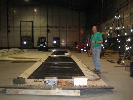
PFSers Larry Gullingsrud and Annelisa Neely deliver boardwalk to Mike Weintraub's tundra plots at Imnavait Creek. Researchers will use the dark material in the background to artificially warm some of the tundra plots. Photo: Jason Neely

University of Toledo’s Mike Weintraub returned to Imnavait Creek near Toolik Field Station last week for the first full season of tundra plot studies supported by his recent NSF grant.  The project is one of a group of new research to be fielded at/near Toolik this year to study changing seasonality in the Arctic (CSAS).  Specifically, Weintraub’s team is looking at how altered timing of seasonal events—earlier spring thaw and later fall freeze, for example—may affect nitrogen cycling in the soil, and how that in turn impacts tundra plant and microbe growth.

Polar Field Services staff returned to Toolik in late April for spring science support and station facilities projects. Among the larger science efforts, Jason Neely’s team placed about 3000 linear feet of boardwalk out on Imnavait Creek tundra manipulation plots for Weintraub’s CSAS soil nutrient experiment.   The boardwalk protects the fragile, slow-growing tundra from the many footsteps of researchers visiting the plots to collect plants, data and/or to manipulate the conditions.  The Weintraub team will continue working on the CSAS project for the length of the summer season at Toolik Field Station, departing in late August.

Weintraub heads an interdisciplinary collaboration composed of four other PIs:  Paddy Sullivan (U Alaska), Josh Schimel (U California), Edward Rastetter (Marine Biological Laboratory), and Heidi Steltzer (Colorado State U).

Researchers will manipulate the timing of seasonally driven processes in tussock tundra ecosystems by advancing the timing of snowmelt with radiation-absorbing fabric placed over the snowpack in the late spring and by using open-top warming chambers in concert with advanced snowmelt. They will follow how seasonally driven plant and soil dynamics are affected by changes in the timing of snowmelt and warming.


GrIT: Beyond Crevassed Zone, Into a Storm

May 4, 2010

All Photos: Robin Davies

The Swing Boss checks wind speed before three GrIT members return to Thule.

The Greenland Inland Traverse (GrIT) team halted progress toward Summit Station on Monday “because of a rather large storm that is affecting the ice cap and Thule,” GrIT project manager Allen Cornelison reported. “The storm has also prevented the helicopter from retrieving Allan Delaney.”

Delaney is the ground-penetrating radar expert who led the team through the crevassed zone. His job now done, he was to fly back to Thule on Monday to begin his journey home. But with the storm forecast to last into Thursday and beyond (and limited flights out of Thule), the team formed Plan B.

“Robin Davies, Willow Fitzgerald and Allan Delaney took the Tucker down to Thule today,” Allen Cornelison reported on Monday.

“Even though the visibility was not great for the 70 miles down the ice cap, it was worse once the team got to the transition. Robin said at times the visibility was so poor along the road from the transition to Thule, they were only able to drive at 2 mph.” That’s when 15 miles can be an excruciating distance.

The three used new Garmin 695 Global Positioning Systems units to Hansel-and-Gretel their way back to Thule:  the GPS instruments (designed for aircraft operations) have been laying down coordinates as GrIT travels inland, and the three in the Tucker found their way back to Thule by closely following the “breadcrumb” path recorded by the software. Cool!

Meanwhile, CRREL’s Jim Lever and the Swing Boss took shelter in their tents at the far edge of the crevassed zone at position B11D. “GoNorth is about a mile past B11C and we would assume hunkered down as well,” Cornelison wrote. “Brad commented that the snow is coming down quite hard but the wannigan (the large camping box and warm-up shelter) is holding up well and they are cozy in their tents.” It may be pouring snow, but the storm brings relatively warm weather—about +20 degrees F.

The GoNorth! dogs are actually warmer when they're drifted in, as they're protected from the wind.

With a break in the weather, the GrIT team will shuffle the traverse cargo load. “Jim commented that the load cells show that the Case and Tucker should be able to discontinue shuttling loads and begin hauling one way,” Cornelison said.

According to the Swing Boss, snow conditions are improving as the team moves inland. And harder snow means the big machine should be able to pull a heavier load.

“Robin and Willow will attempt to return to camp Tuesday and all will continue to move forward,” Cornelison’s report concluded. ‘This is of course if they can see enough to move forward.”

The Greenland Inland Traverse is funded by the National Science Foundation (NSF). CH2M HILL Polar Services and Cold Regions Research and Engineering Laboratories are working together with the NSF to develop the traverse infrastructure and route. The 2010 spring traverse has several foci: find a safe overland route to Summit Station to help reduce logistical costs and environmental impacts of conducting research there; provide a research platform for scientists conducting field work in Greenland; optimize mobility by focusing on the sled/snow interface.  For more field notes coverage of GrIT, click here

GrIT contact:
Allen Cornelison, Polar Field Services, CH2M HILL Polar Services
GrIT Project Manager

Allen at polarfield.com


Summit Readies for Spring Research

May 4, 2010

This LC-130, fitted with special 8-bladed propellers, delivered CH2M HILL Polar Services staff to Summit Station last week. Photo: Mary McLane

They are our swallows at San Capistrano, the newly arrived CPS summer staff.  Harbingers of the research season to come, they flock to Summit Station just ahead of the first group of scientists, to assist with final preparations. And they arrived last week during a warm spell.

A warm spell that softened Summit’s long skiway enough to bog an LC-130, Skier 92, on 28 April. After repeated unsuccessful passes down the strip, the New York Air National Guard 109th Airlift Wing’s flight crew bunked at the station, along with the phase three winter staff and others who had been trying to depart on the outbound.

Summit staffer Marie McLane tries out the co-pilot seat in Skier 92. LC-130s rarely linger on snow, so this chance to explore the cockpit at Summit's front door couldn't be ignored. Photo: Sonja Wolter

CPS staff worked the heavy machines up and down the skiway all night to prepare for the next round on Thursday.

The Air National Guard sent the big guns–or propellers–on Thursday: Skier 93, fitted with special 8-bladed propellers.  Skier 92 offloaded all of its passengers and most of its cargo, and after five passes, it finally was able to lift off for Kangerlussuaq.  Skier 93 soon followed, loaded with passengers and cargo from the original plane, after only two passes down the skiway. “The eight bladed prop makes an amazing difference,” wrote station manager Ken Jessen.

Read about the NP2000 8-bladed propellers in this field notes blog post.

With planes off the skiway,  Summit staff continued preparing the station for spring researchers. Noted polar explorer (University of Colorado) Koni Steffen will stop in during his Twin-Otter-supported maintanence visit to the automated weather station at Summit.

All smiles: Camp Manager Ken Jessen, after an afternoon spent shoveling out the Summit fuel bladders. Photo: Katrine Gorham